Vancouver Market - Chronicling Investment and Development Activity in Metro Vancouver
  • Home
  • Listings & Sales
  • Land Assembly
    • Official Community Plans (OCPs)
      • City of Burnaby
      • City of North Vancouver
      • District of North Vancouver
      • City of Vancouver
      • District of West Vancouver
    • Transit Oriented Areas (TOA) Policy
      • City of Burnaby
      • City of New Westminster
      • City of Vancouver
      • Transit Oriented Areas: How New Zoning Policy Affects Landowners
  • About
  • Subscribe
Vancouver Market - Chronicling Investment and Development Activity in Metro Vancouver
Home
Listings & Sales
Land Assembly
    Official Community Plans (OCPs)
    City of Burnaby
    City of North Vancouver
    District of North Vancouver
    City of Vancouver
    District of West Vancouver
    Transit Oriented Areas (TOA) Policy
    City of Burnaby
    City of New Westminster
    City of Vancouver
    Transit Oriented Areas: How New Zoning Policy Affects Landowners
About
Subscribe
  • Home
  • Listings & Sales
  • Land Assembly
    • Official Community Plans (OCPs)
      • City of Burnaby
      • City of North Vancouver
      • District of North Vancouver
      • City of Vancouver
      • District of West Vancouver
    • Transit Oriented Areas (TOA) Policy
      • City of Burnaby
      • City of New Westminster
      • City of Vancouver
      • Transit Oriented Areas: How New Zoning Policy Affects Landowners
  • About
  • Subscribe
Development, Retail

Details of Heather Lands Redevelopment Include 12 Towers, 2.3 Million SF

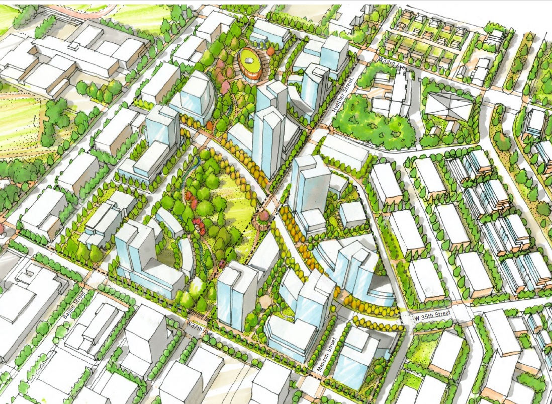
The City of Vancouver has released the Policy Statement for the Heather Lands site, a 21 acre site located just West of Cambie Street, between West 33rd and West 37th. The site is jointly owned by Canada Lands Company,  the Musqueam Indian Band, Squamish Nation and Tsleil-Waututh Nation (the “MST Nations”). It was previously occupied by the RCMP, which moved to a new headquarters in Surrey in 2012. There remains a heritage building on site, the Fairmont building.

A comprehensive planning program was initiated for the site in 2016, which aligned with the recently adopted Cambie Corridor Phase 3 planning program. Several stakeholder and community consultations sessions and open houses occurred over 2017, culminating with the Policy Statement which will guide the future rezoning and redevelopment of individual parcels within the overall Heather Lands site, similar to processes for other large sites like Pearson Dogwood, Oakridge Transit Centre Site, and Langara Gardens.

An important aspect guiding the policy statement has been reconciliation with the MST Nations.

Details of the overall land use policy include:

  • An overall maximum density of 2.50 FSR (2,296,000 SF);
  • Approx. 2,500 residential units;
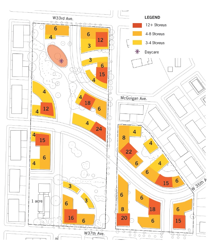
  • Heights from 3 to 24-storeys;
  • A minimum of 20% of units for affordable housing (approx. 530 units);
  • 20% of units as ‘attainable home ownership’ (approx. 530 units);
  • 20,000 – 60,000 SF of local serving retail & service uses (ie. cafe, small grocery, pharmacy, medical office);
  • One acre site for potential 4-storey Conseil Scolaire Francophone school;
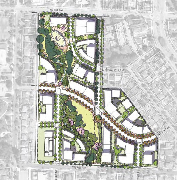
  • Minimum 4 acres of secured park and open space (min. 2 acres public park);
  • A new 69-space childcare facility;
  • A cultural centre (minimum 15,000 SF);
  • Potential demolition or relocation of the Fairmont building;
  • New 35th Avenue connection through site;
  • A new neighbourhood commercial street inside the site;
  • Extension of Baillie Street and Manson Streets into the site;
  • Redesign of Heather Street to accommodate new Heather Street bikeway.

The Policy Statement describes the built form: “The Heather Lands will be characterized by a variety of building forms, including lower forms and townhouses framing parks and open spaces, mid-rise buildings along the streets and some taller buildings organically located to follow the forest trail. The cultural centre and childcare facility will be prominently located on the site, anchoring the neighbourhood heart.”

The full policy report can be viewed here: http://council.vancouver.ca/20180515/documents/rr3.pdf

May 10, 2018by david.taylor@colliers.com
Apartment, Development, Office, Retail

Two New Tower Proposals for Coquitlam

Two new tower proposal go to first reading at the City of Coquitlam next week, one in Burquitlam and one in the City Centre area of Coquitlam. The two projects are detailed below:


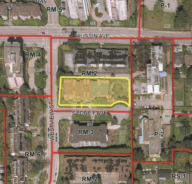
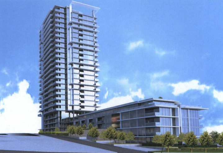
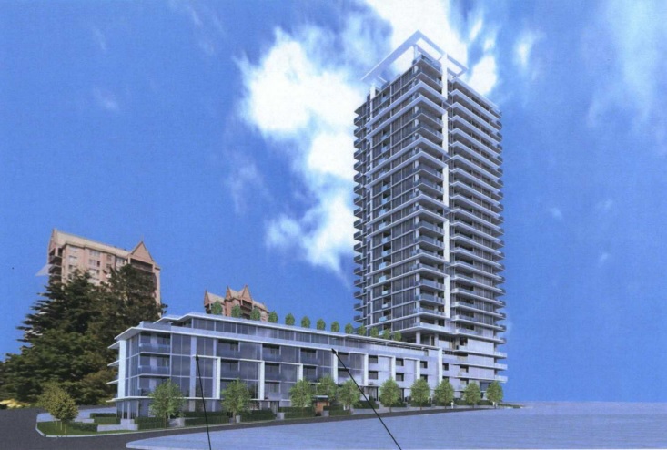
545 Sydney Avenue

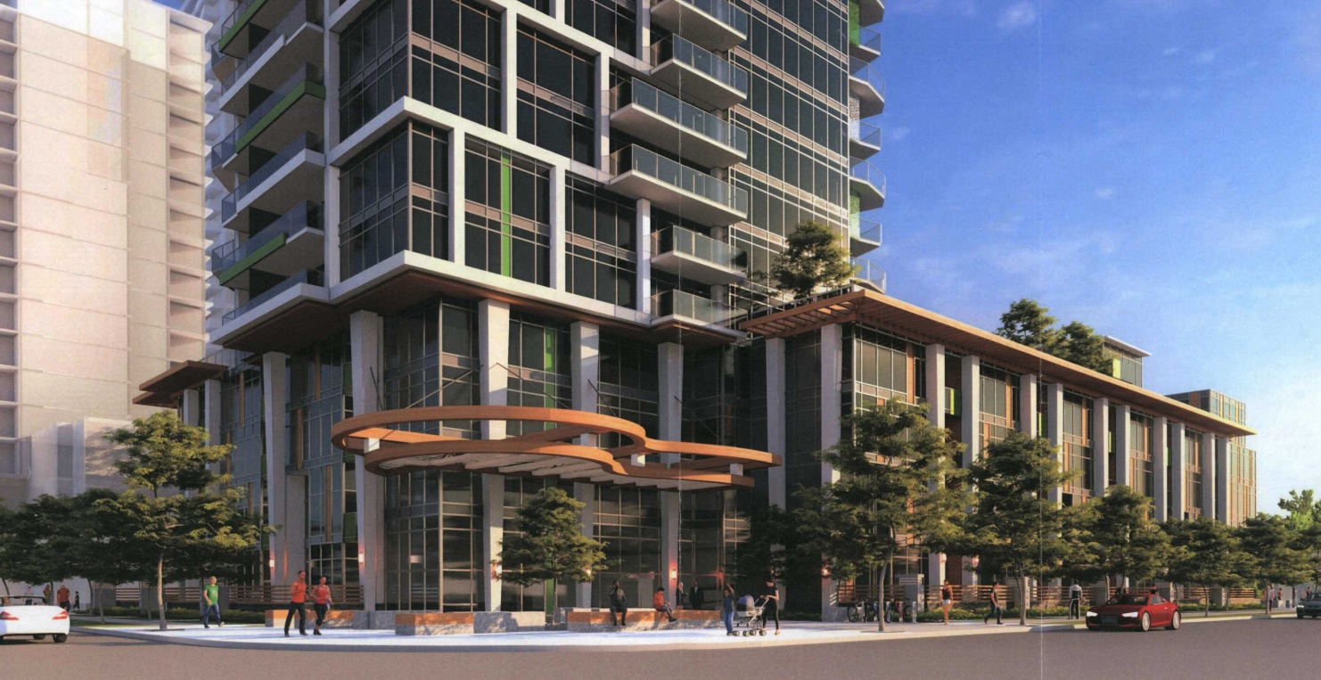
This proposal is by Ledingham McAlister for a site in the booming Burquitlam neighbourhood along North Road. The site is 0.8 acres and is located at the Northeast corner of Westview Street and Sydney Avenue. 

The site is currently occupied by a 3-storey condo building and the plan calls for rezoning from RM-2 to a Comprehensive Development Zone (CD) based on the RM-6 Multi-Storey High Density Apartment Residential Zone in the Official Community Plan.

The plan is for a new 25-storey residential tower that includes:

  • 235 total residential units;
    • 157 condos
    • 78 rental apartments;
  • a total density of 5.50 FAR;
  • 283 underground parking spaces.

  The site sold in January 2018 for $15,575,000.

The architect for the project is IBI Group.


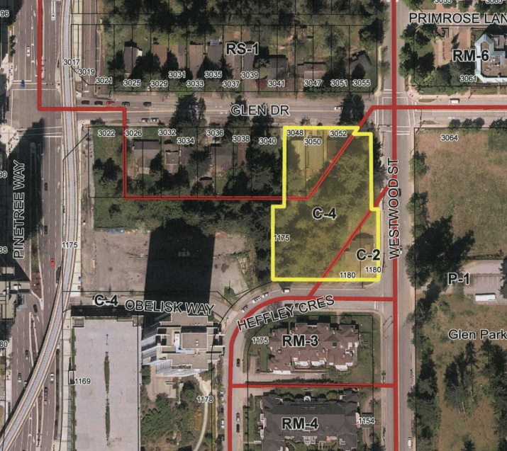
1108 Westwood Street

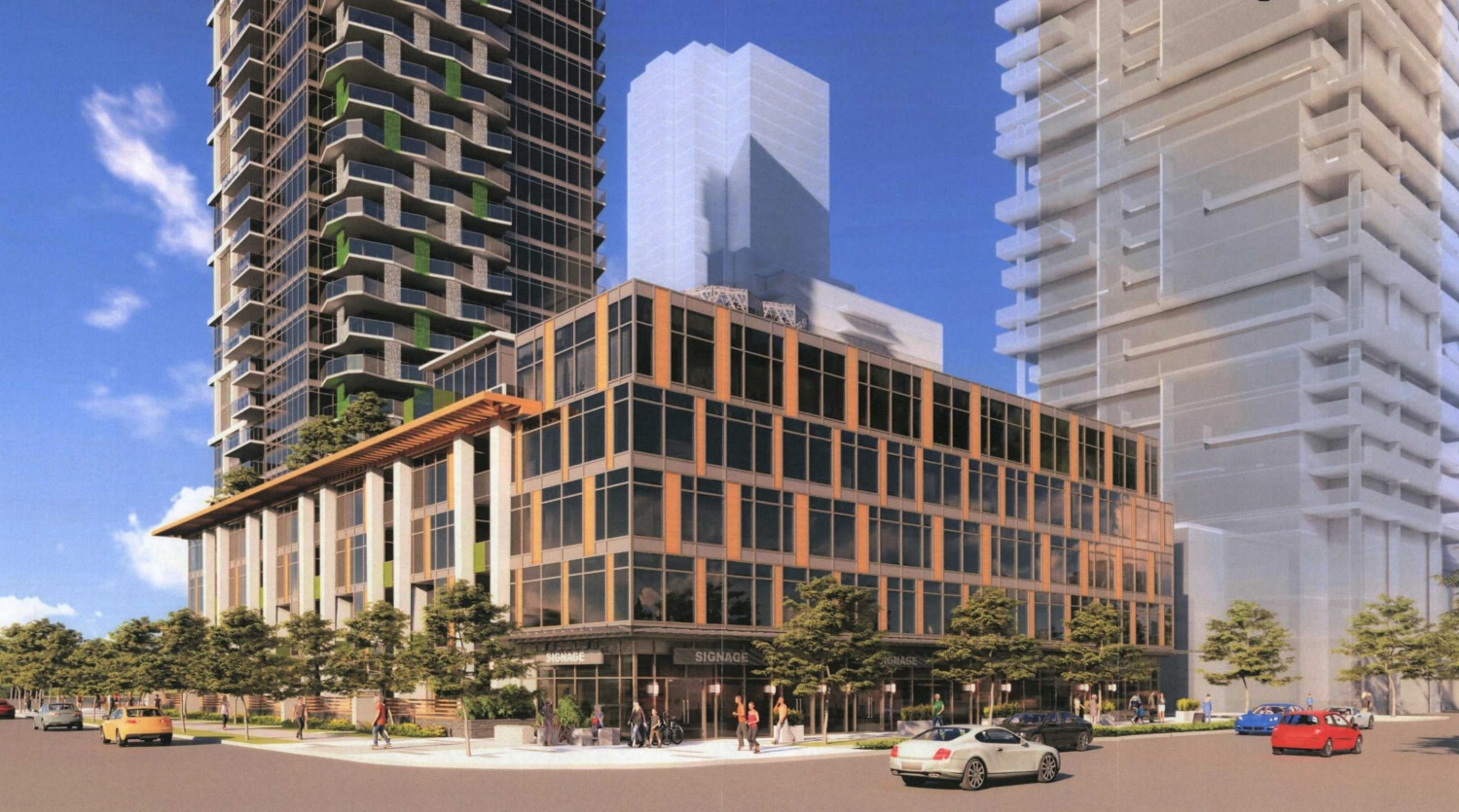
Polygon Homes has submitted their application for this site at the southwest corner of Glen Drive and Westwood Street in the City Centre area of Coquitlam. The 1.1 acre site is mostly vacant and comprises an assembly of three lots.

The site sits adjacent a site controlled by Onni (fronting Pinetree Way), which will also be applying for a rezoning for a tower using the same architect, Chris Dikeakos. There is a master plan in place which governs the development of both sites.

The site is located within the City Centre Area Plan (CCAP), is designated City Centre Commercial in the OCP, and is located within the “Core” area of City Centre in the Transit-Oriented Development Strategy (TDS). The proposed rezoning to CD is based on the C-4 Zone which is the applicable zone in the City Centre Commercial designation in the CCAP.

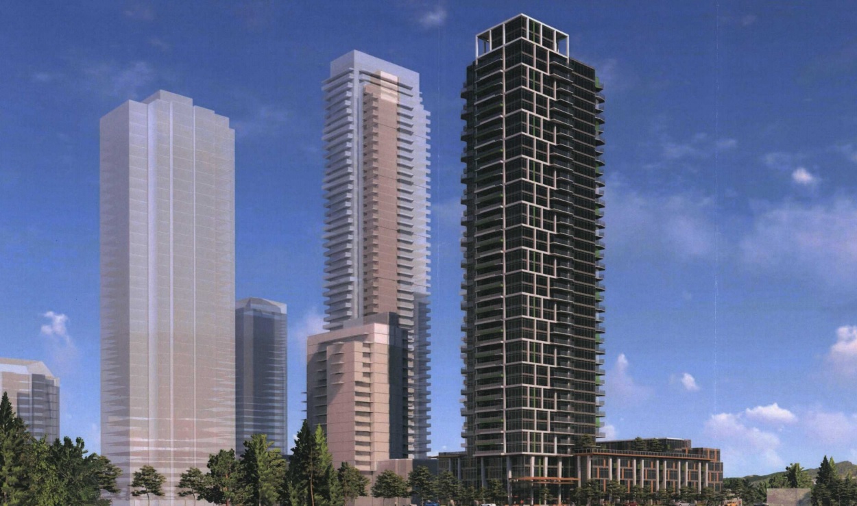
The plan calls for a 40-storey residential tower that includes:

  • 273 residential units:
    • 222 condo units;
    • 51 rental apartment units;
  • Four retail units;
  • 4 floors of office space (24,000 SF total commercial space);
  • 19,813 SF of amenity space;
  • A total density of 6.40 FAR;
  • A total building height of 406 ft.;
  • 437 underground parking spaces above and below grade (due to high water table)


May 4, 2018by david.taylor@colliers.com
Apartment, Development, Retail

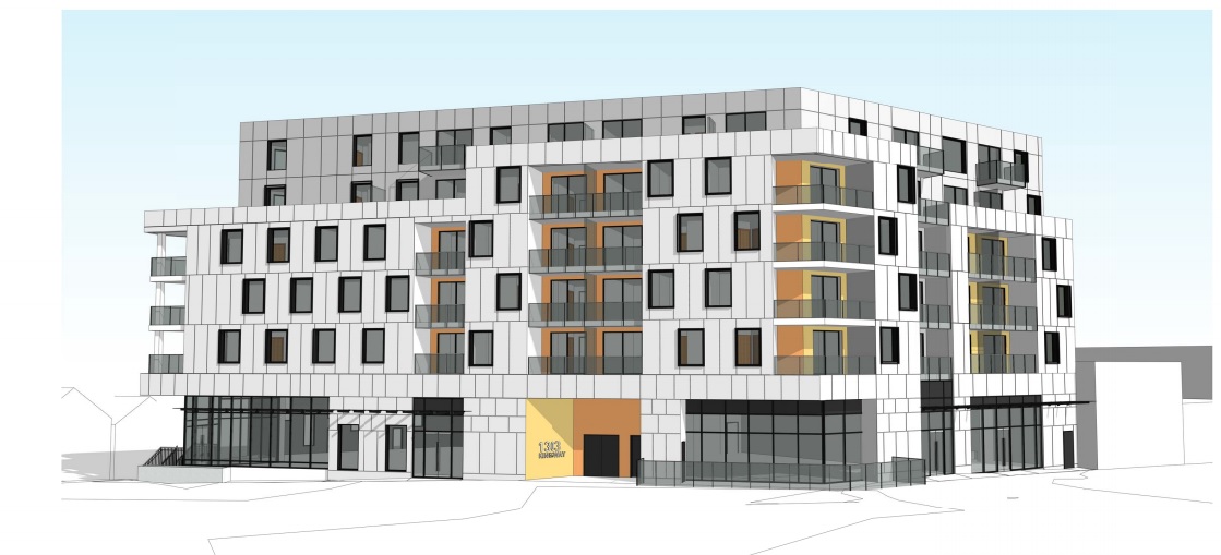
Kingsway & Clark Corner Slated for 53 Rental Units

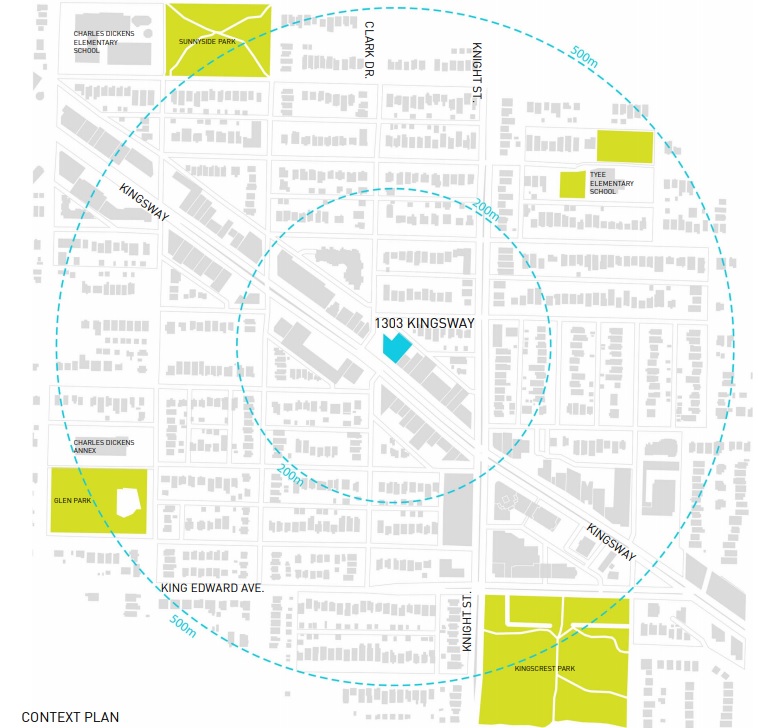
The latest Kingsway rental rezoning application to be submitted to the City of Vancouver is for a site at the Northeast corner of Kingsway and Clark Drive, one block West of Knight Street.

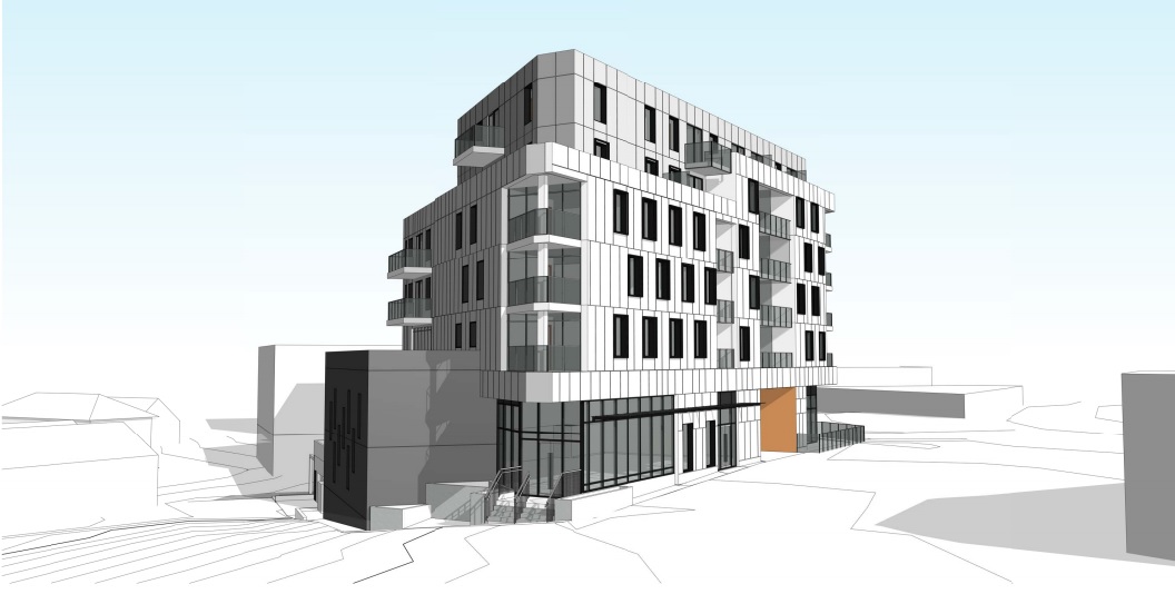
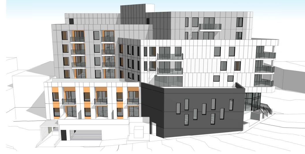
The 14,134 SF site is currently improved with single storey retail including the Cedar Cottage Neighbourhood Pub and Liquor Store. The site is zoned C-2. The rezoning proposal seeks approval for a new six-storey mixed-use building, consisting of:

    • 53 market rental units;
    • 10 studios, 24 one bedrooms, 13 two-bedrooms and 6 three-bedrooms;
    • 7,884 SF of retail space at grade;
    • a total density of 3.77 FSR;
    • a building height of 74.64 ft.; and
    • 43 underground parking spaces.

This application is being considered under the Secured Market Rental Housing (Rental 100) Policy.

The site was acquired in 2017 for $5,840,000, or $102 per buildable SF based on the application.

The architect for the project is GBL Architects.

April 24, 2018by david.taylor@colliers.com
Page 135 of 240« First...102030«134135136137»140150160...Last »

Search the Site

Tweets by vancouvermrkt

Categories

  • Apartment
  • Condo
  • Development
  • For Sale
  • Hotel
  • Investment
  • Land
  • Market Research
  • Office
  • Rental
  • Retail


David Taylor Personal Real Estate Corporation

Colliers International

© 2019 Copyright  |  All Rights Reserved